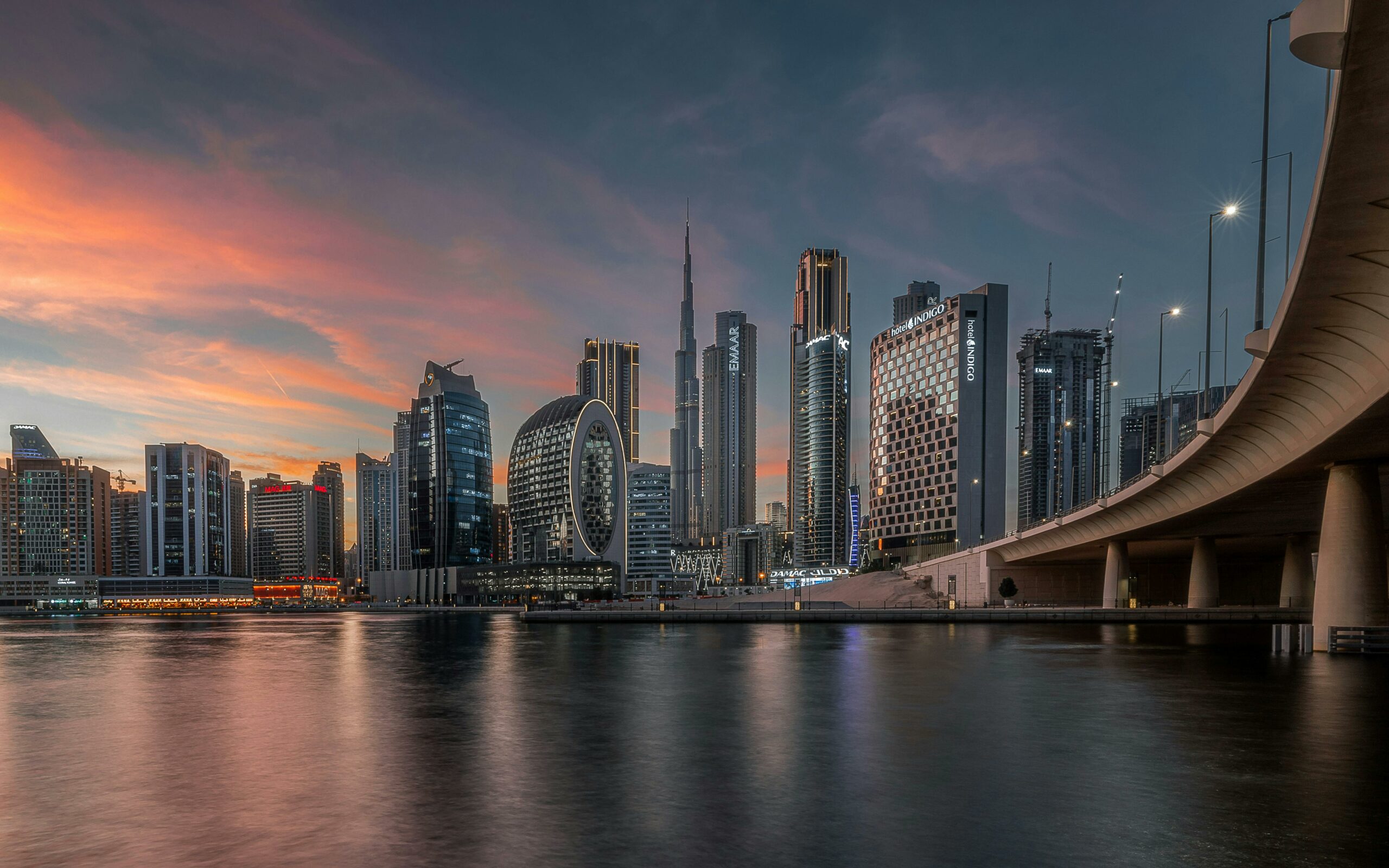
Rethinking mobility in Dubai to shape a less car-dependent future for the largest business district in the world
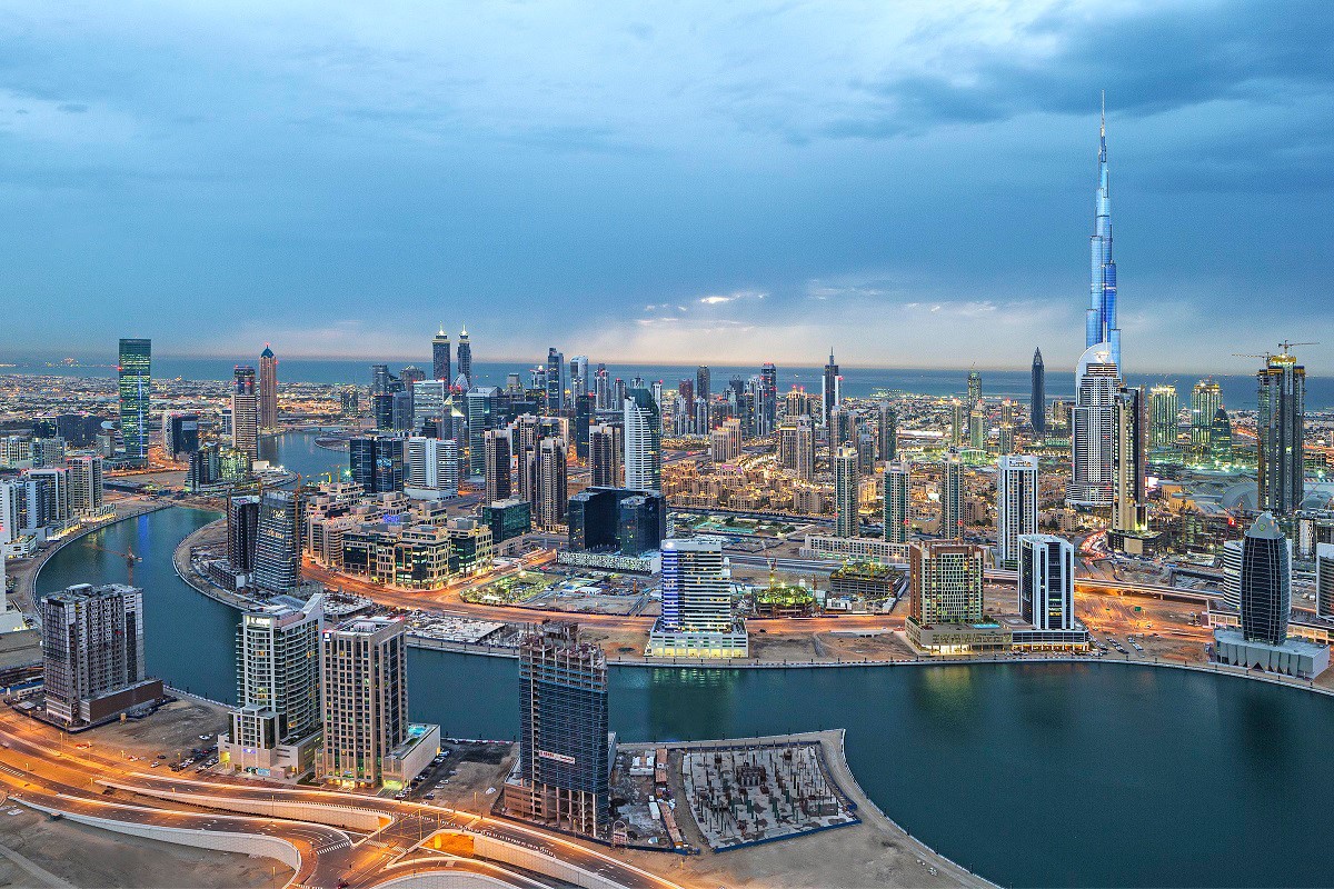
Launched in 2005 with the ambition to become the largest business district in the world (80 million sq. ft), Business Bay has evolved its original vision to respond to shifting market demands. Today, the area integrates a diverse mixed-use typology, blending residential, hospitality, and entertainment functions, highlighted by the water canal inaugurated in October 2016.
Despite its strategic location, Business Bay presents unique challenges and opportunities. In 2017, only one-third of the area was developed, so certain zones lacked the density to activate public spaces, while abundant available land provided the chance to optimize the original master plan and experiment with innovative mobility solutions.
One of the main goals was to reduce car dependency and transform Business Bay into a walkable, human-centered urban environment—a significant challenge in a city like Dubai, where climate and traffic patterns often discourage pedestrian activity.
Systematica was appointed as a specialist transport consultant to 5+Design, the lead architectural firm, to develop the Transport Master Plan for Business Bay.
Our mission was to deliver a comprehensive mobility strategy aligned with the district’s vision as a world-class, vibrant mixed-use community. The plan addressed all modes of transportation, including private vehicles, public transport, and soft mobility networks, to create safe, attractive, and connected streetscapes.
Systematica adopted an integrated, data-driven approach to create actionable guidelines. Our analysis revolved around:
- Reducing car dependency through multimodal alternatives
- Optimizing public transport integration and plan capillary accessibility
- Improving pedestrian experience and walkability
- Implementing traffic calming measures for safer streets
- Designing an efficient cycling and soft mobility network
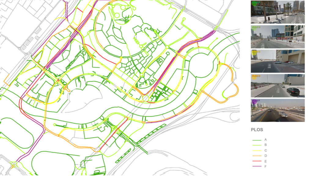
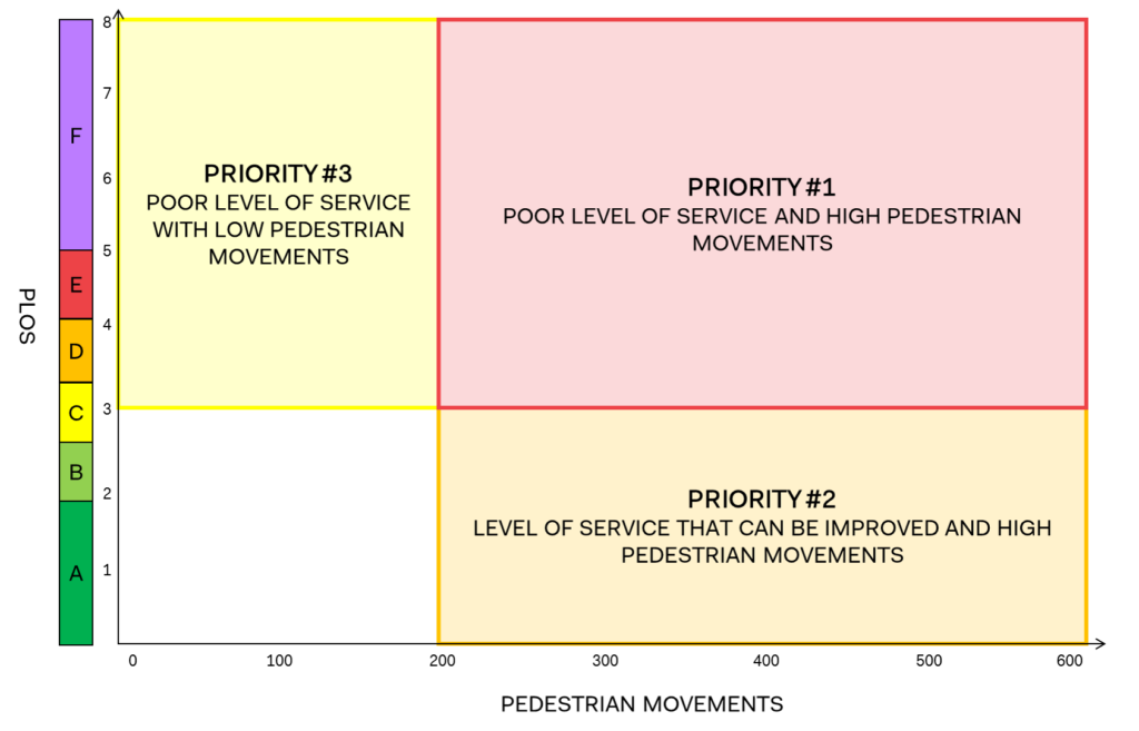
A core component of our work was the assessment of Pedestrian Level of Service (PLOS) across the street network, through the development of a detailed GIS-based model. This analysis evaluated sidewalk quality, pedestrian comfort, connectivity, and safety, to rank each street’s performance on an A-to-F scale. The objective was to establish a roadmap of interventions and prioritize them based on expected pedestrian volumes, as defined by the pedestrian traffic model we developed.
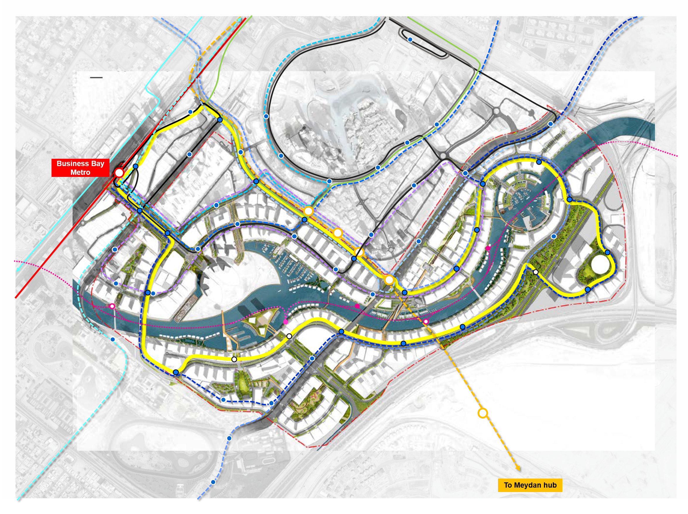
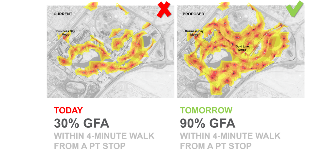
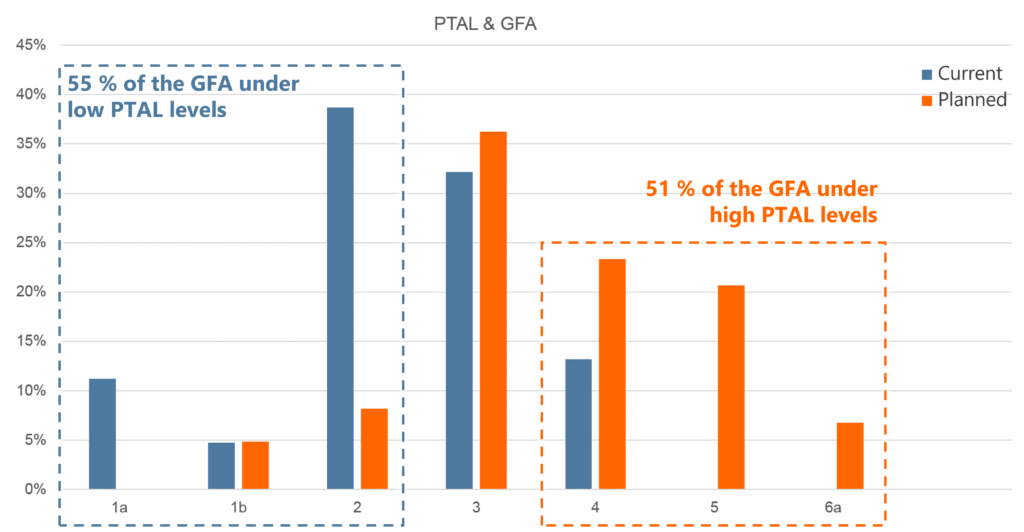
The study also examined Public Transport Accessibility Levels (PTAL) to evaluate the effectiveness of existing and proposed transit services. This informed recommendations for new public transport corridors, enhanced bus services, improved interchange facilities, and future mass transit integration.
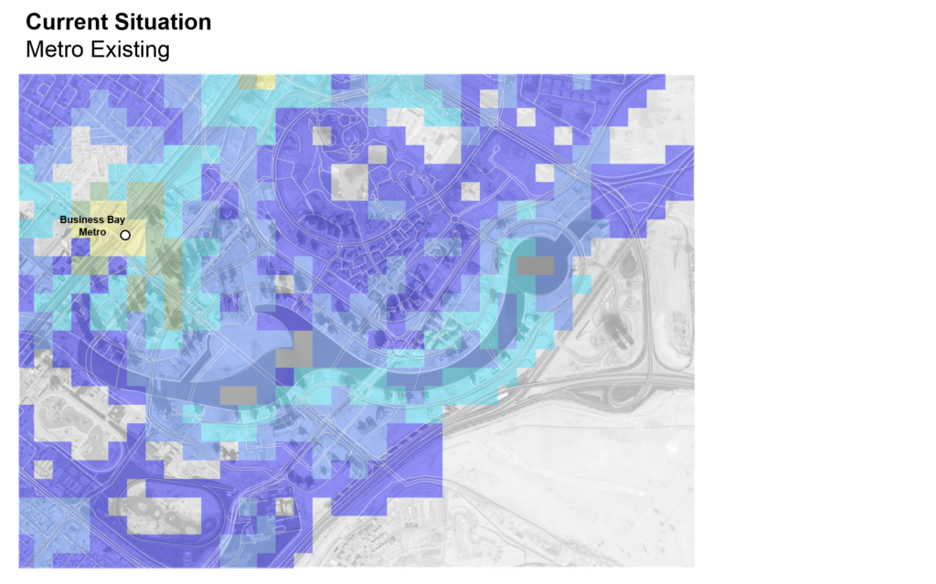
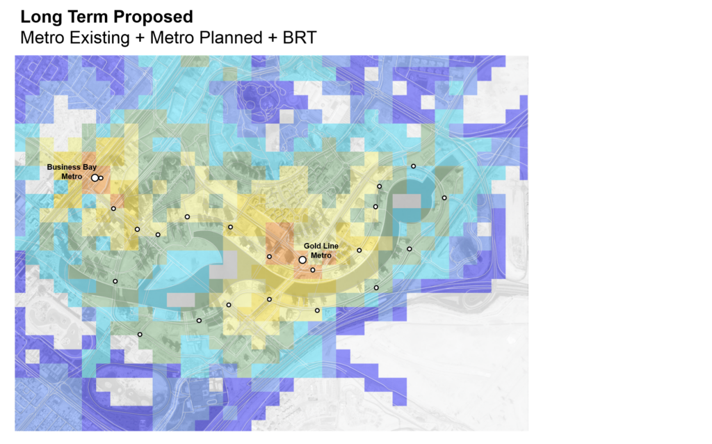
By aligning with Dubai Public Authorities’ goals and integrating international best practices, the plan provides a scalable framework for a future-proof, sustainable urban environment.
Systematica’s Transport Master Plan delivered efficient strategies to make Business Bay a more walkable, connected, and vibrant district, while minimizing private vehicle use.
One of our goals was to ensure a multimodal transport network. Thus, the plan laid the groundwork for implementing mass transit, such as the Orange Metro Line and dedicated bus corridors. At the same time, it supported seamless interchanges between existing public transport options, especially from bus to bus and from metro to bus.
The PLOS assessment enabled the prioritization of public realm improvements according to pedestrian demand and existing conditions. Areas with high pedestrian activity and poor walking environments were identified as immediate priorities, while additional interventions were phased to support medium- and long-term improvements across the district.
The proposed measures included:
- Wider sidewalks
- Potential new bridges
- Enhanced landscaping
- Shaded pedestrian routes
- Improved separation between pedestrians and vehicular traffic
These interventions were specifically designed to improve comfort, safety, and walkability within Dubai’s climate while encouraging greater use of active modes of transport.
By putting mobility and user experience at the core of urban design, Business Bay is now a renowned destination that balances high-density development with sustainable, human-centered transport solutions.