Strengthening multimodal connectivity across the West Bank and Gaza Strip
The Road and Transportation Master Plan for the West Bank and Gaza Strip represents the first comprehensive national transport strategy developed by the Palestinian National Authority since its establishment in 1994. The plan aims to define a long-term vision for the Palestinian transport sector, creating a coordinated framework for mobility, infrastructure development, logistics, and regional connectivity across the West Bank and Gaza Strip.
A key objective of the master plan was to integrate the West Bank and the Gaza Strip into a single, coherent transport system through the development of a multimodal network and a phased implementation strategy. The project required the integration of road, rail, public transport, freight, border crossings, aviation, and maritime infrastructure into a single strategic framework capable of supporting economic growth, territorial accessibility, and institutional development.
The project presented significant challenges due to its geographic scale, political sensitivity, and the need to coordinate multiple transport modes and institutional stakeholders. Designing a transport framework capable of supporting economic growth, regional integration, and efficient mobility required a robust analytical approach and a long-term strategic vision.
Systematica developed a comprehensive Road and Transportation Master Plan composed of two main components: a Spatial Design Master Plan and an Implementation Program Plan.
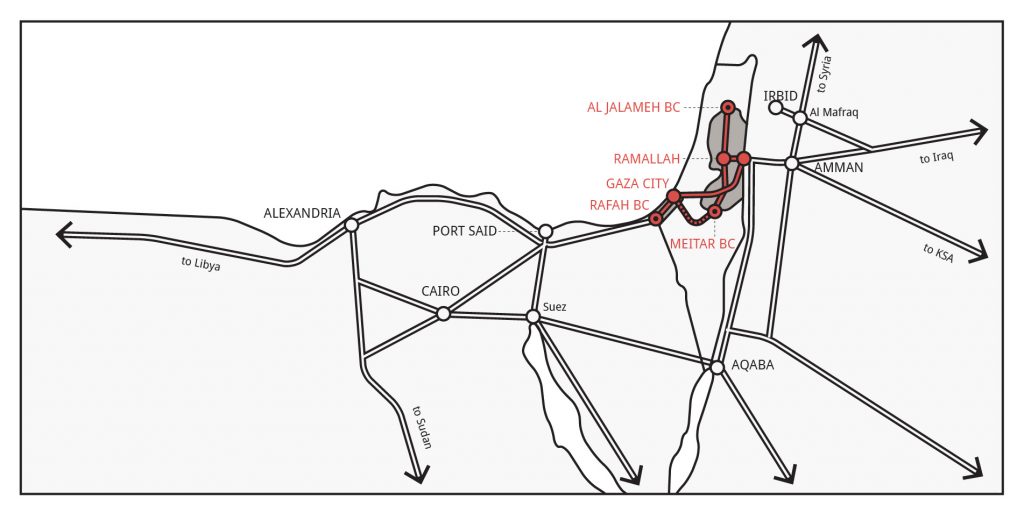
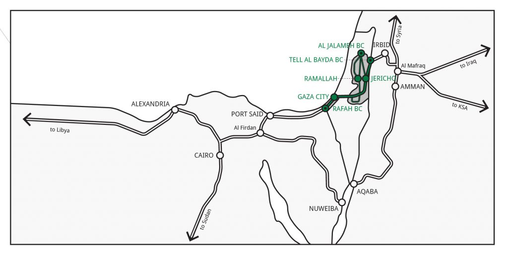
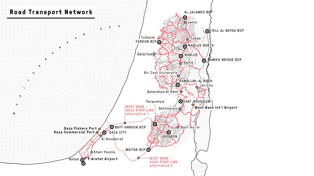
The Spatial Plan defined the long-term structure of the national transport network, centered around a strategic North-South multimodal corridor connecting Tarqumiya in the West Bank with Bayt Hanoun in the Gaza Strip, while addressing the full range of transport sub-sectors, including land transport, public mobility systems, air and maritime networks, border crossings, and freight logistics.
Alongside the spatial strategy, Systematica developed an implementation-oriented program framework aimed at supporting project prioritisation, investment sequencing, sector reform, and long-term institutional development.
Through this work, Systematica provided a strategic framework to support policy development, infrastructure investment, and sector reform, enabling the Palestinian National Authority to prioritize projects and attract international funding.
The master plan combined strategic spatial planning with an implementation-oriented program framework.
While the Spatial Plan defined the long-term structure of the national transport network, the Program Plan established the roadmap for its implementation, identifying priorities, phasing strategies, and investment timelines across the short, medium, and long term.
The methodology integrated mobility planning, territorial accessibility analysis, logistics and freight considerations, and multimodal transport strategies into a unified planning framework capable of supporting both immediate operational improvements and long-term sector transformation.
Particular attention was dedicated to ensuring the adaptability and scalability of the master plan, enabling future policy updates, infrastructure expansion, and institutional development over time.
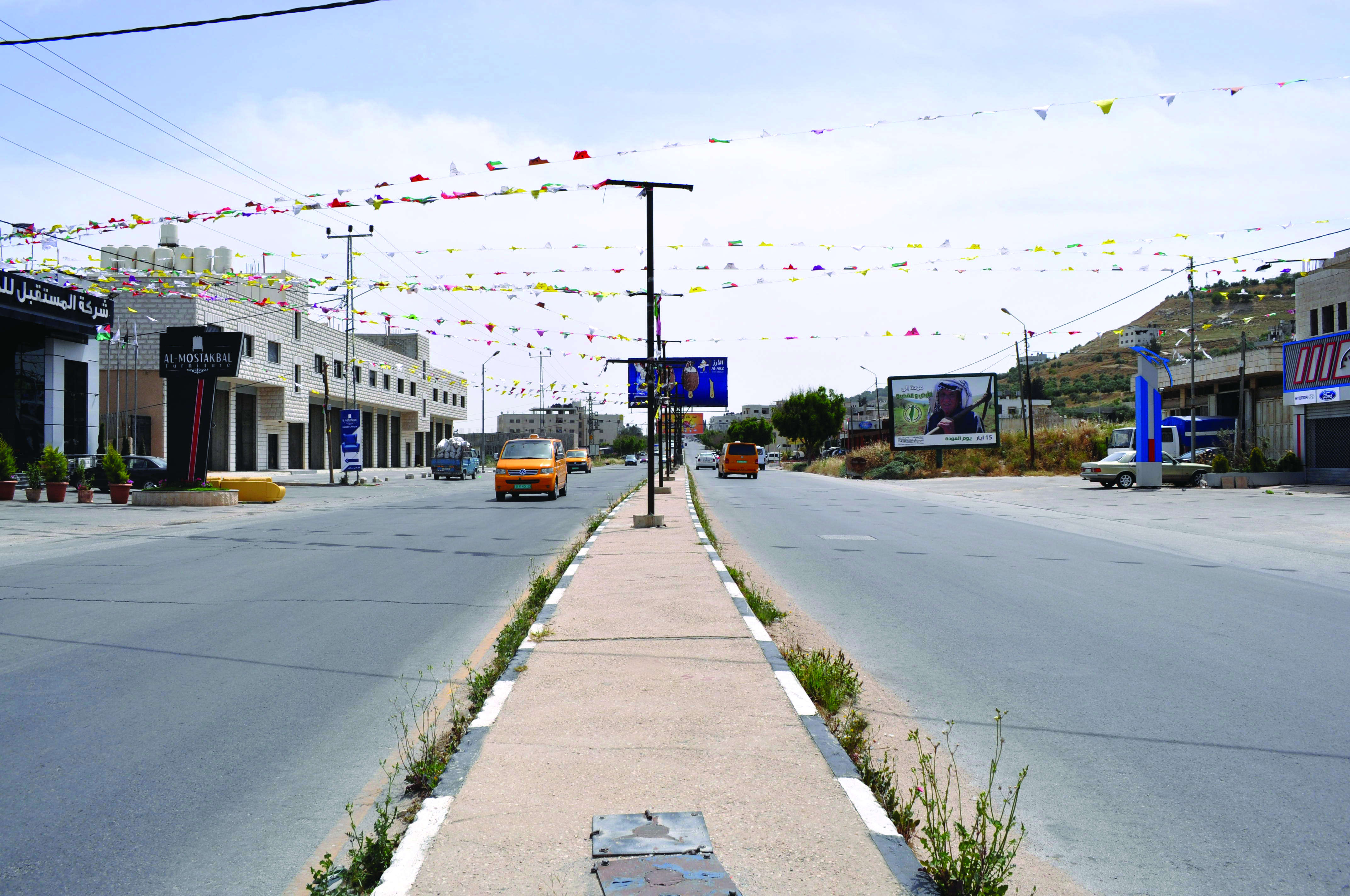
The master plan outlines a comprehensive multimodal transport network designed to strengthen connectivity, improve logistics efficiency, and support economic development across the West Bank and Gaza Strip.
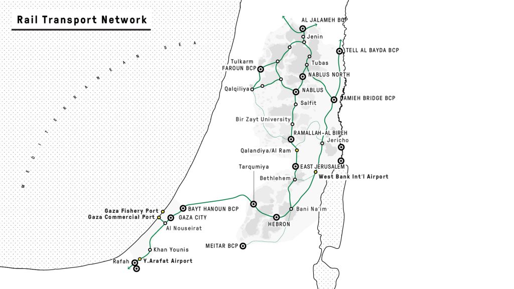
At its core is the proposal for a North-South multimodal backbone corridor, combining rail and road infrastructure and supported by a network of secondary East-West connections to improve territorial accessibility. The plan also includes the development of new multimodal infrastructure and the modernisation of border crossing facilities to facilitate freight movement and regional trade.
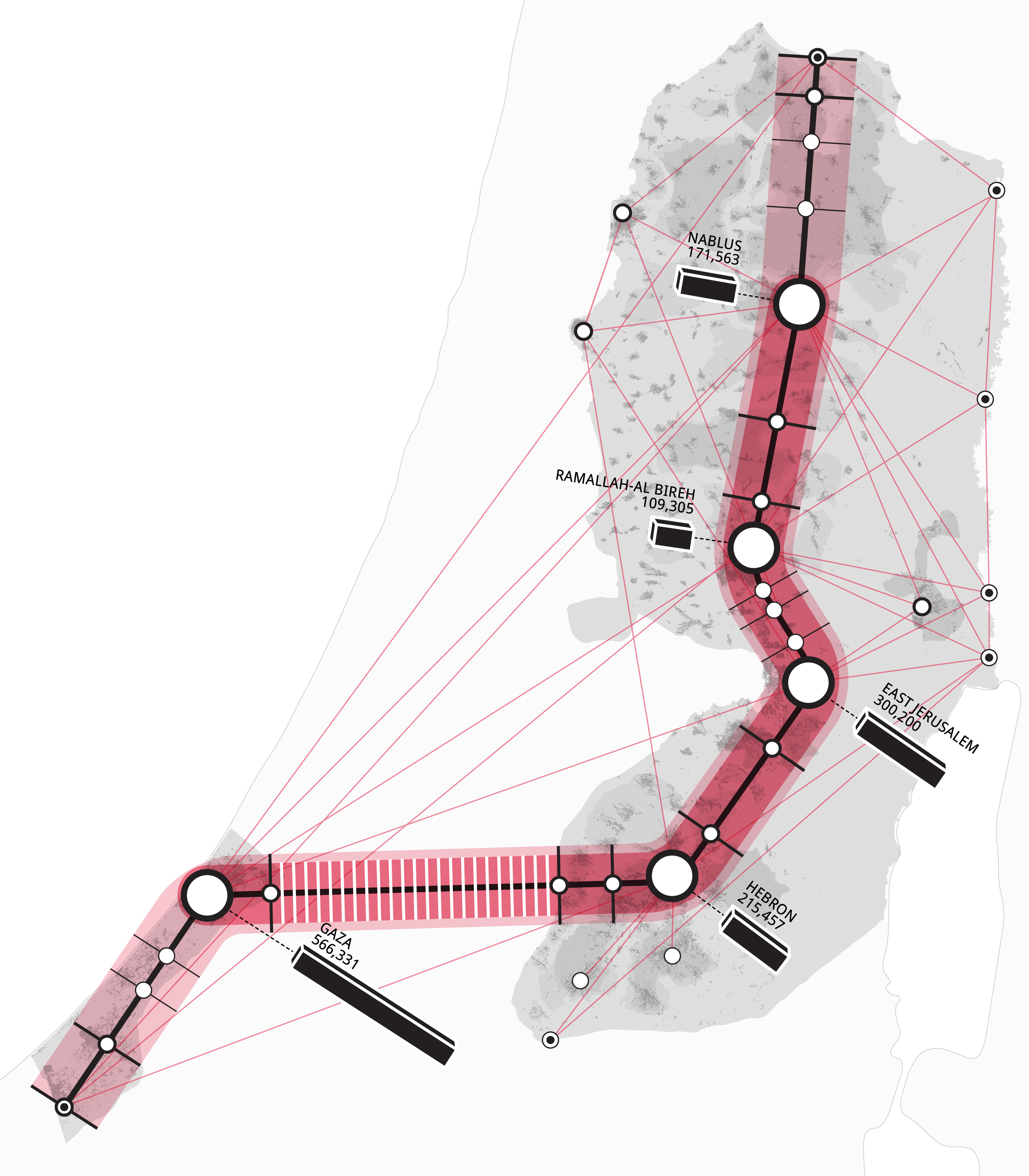
Key infrastructure proposals include new national and international railway lines, improvements to maritime and aviation facilities, and the introduction of modern public transport systems, such as Bus Rapid Transit, in major Palestinian cities including Bethlehem, East Jerusalem, Gaza City, Hebron, Nablus, and Ramallah.
Beyond infrastructure planning, the project also contributed to long-term institutional capacity building through the transfer of technical knowledge and the delivery of dedicated training activities for local professionals and stakeholders.
Systematica delivered a strategic roadmap for a modern, integrated, and multimodal transport network, supporting improved mobility, stronger economic connectivity, and enhanced regional integration across the Palestinian territories.